

Land
Land
Geography and Climate

Image by Lucidity Info Design, LLC (lucidityid.com)
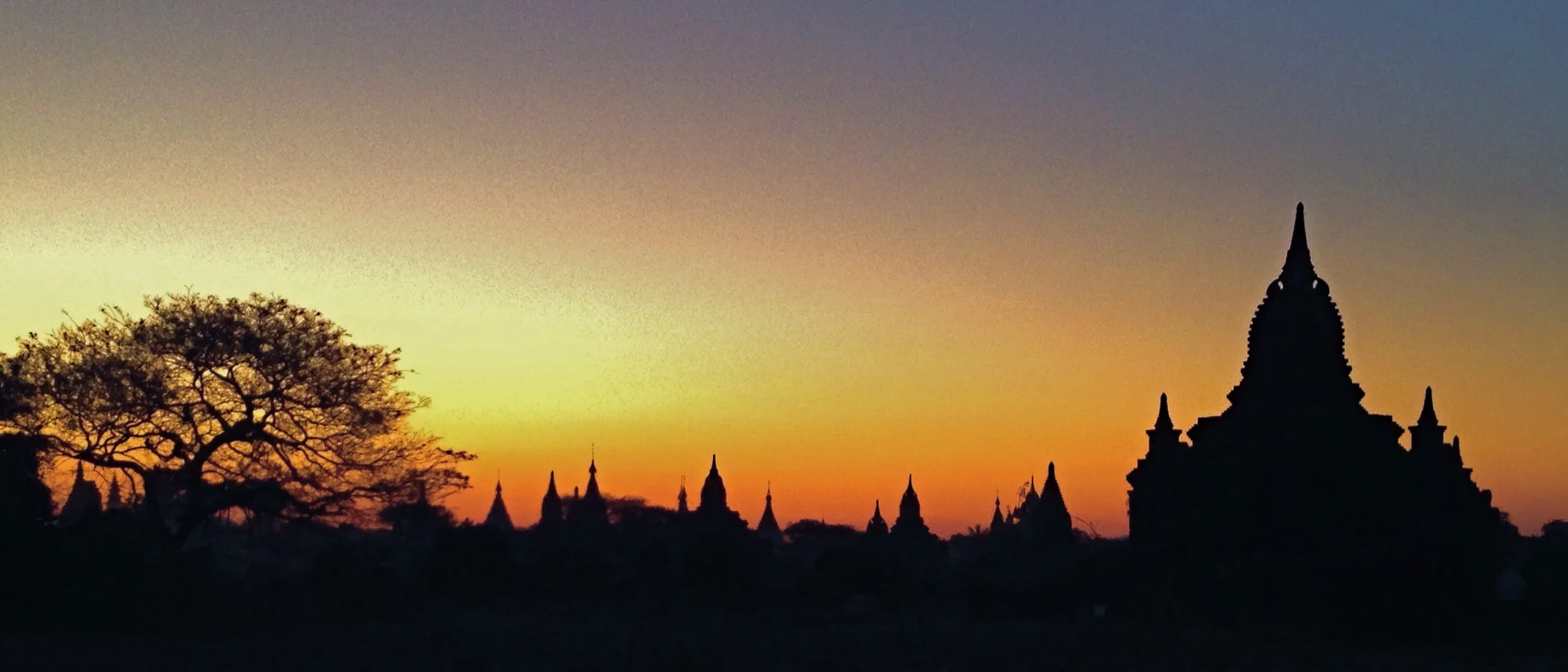
Myanmar is the largest country in mainland southeast Asia, slightly smaller than the state of Texas. The country consists of 14 regions and states. It shares borders with the Indian Ocean and a number of countries including Bangladesh, India, China, Laos and Thailand. Below is a breakdown of the five main geographic areas.
The North
Kachin State and Sagaing Region reside in the north. The tallest peaks in Myanmar, part of the Himalayan foothills, lie at the northern limit near the Chinese border. Accordingly, this is the coolest region with average temperatures of70°F (21°C). Myanmar's longest river, the Irrawaddy River, runs south through Kachin from its source far in the Himalayas. Despite having a monsoon season, the annual rainfall is less than 40 inches, and part of the country's Dry Zone is located in lower Sagaing.
The West
The remote and mountainous Chin State and Rakhine State are found here. The Chin Hills extend south into the Rakhine Mountain range. On their western slopes are dense forests of tall pines that receive plenty of rain. Large storms forming in the Bay of Bengal pour up to 200 inches of rain annually in parts of the region. The tall mountains, however, deprive Myanmar's central valley from much needed rain.
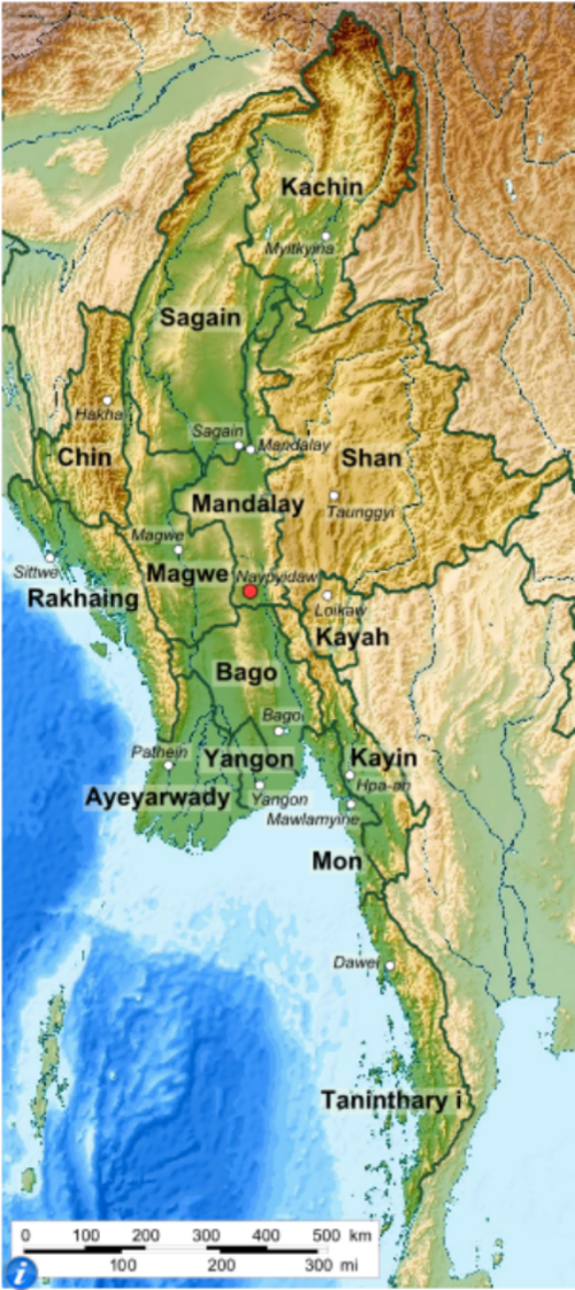
Image by Wikipedia
The East
Shan State and Kayah State lie to the east. The Shan Plateau dominates most of the landscape with steep hills and dense forests. The rapid currents of the Salween River, Myanmar's second longest river, slice through the eastern part of Shan State with tall canyon walls towering on both sides. One of the country's largest and highest lakes, Inle Lake, is also found in this region. The average temperature is similar to the northern region, pleasantly warm during the day with a dramatic drop at night due to the altitude. Rainfall is upwards of 60 inches in the hills and 40 inches in the valleys.
The Center
Mandalay Region and Magway Region make up the central valley and most of the country's Dry Zone. It is the driest region in all of southeast Asia. The second and third largest cities in Myanmar, Mandalay and Naypyidaw accordingly, are here. As of 2005, Naypyidaw also serves as the administrative capital city of Myanmar. The Irrawaddy and Sittang Rivers are crucial in giving life to an area that receives only 35 inches of rainfall annually. Irrigation systems connected to the rivers have made the area a significant farming region.
The Lower
Yangon, Bago, and Ayeyarwady Regions sit lower on the map bordering the Indian Ocean. Yangon, the previous country capital, is the most populous city and region. The Irrawaddy delta region permeates through much of Ayeyarwady, Yangon, and parts of Bago. The lower expanse typically receives over 100 inches of rain annually which, along with the fertile delta soil, makes them ideal for farming. Ayeyarwady and Bago are the two largest producers of rice nationwide. Aside from the low lying Bago Hills, the region has a more tropical climate with high humidity and average temperatures of 81°F (27°C).
The South
Kayin State, Mon State, and Tanintharyi Region are the 500 mile long tail of Myanmar. The Bilauktaung Mountains split the border with Thailand while the Mergui Archipelago sits off the western coast. With these districts closest to the equator, they experience little change in temperature and torrential rain year round. Needless to say, the majority of Myanmar's rain forests are found here.
Ethnic Groups
Ethnic Groups
Even a detailed map like the one at left does not do justice for the ethnic diversity found in Myanmar. Titles and districts such as "Kachin" or "Shan" are umbrella terms for a more complex web of subgroups within a given region. Most subgroups, though, are descended from just four ethnic families: the Tibeto-Burman, Tai, Mon-Khmer, and Karen - the last of which is considered a distant subgroup of Tibeto-Burman.
These people have a culture deeply rooted in Buddhism, Islam, Hinduism, and, more recently, Christianity. The practice of Christianity did not come until the 20th century as a result of British and American missionaries. Ethnic groups have high concentrations in, but are not exclusive to, the corresponding regions.
History
History
Beginnings

Pagan Empire war mural from the 15th century CE
The area today known as Myanmar, formerly Burma, has been a land of contention and conquest since the beginning.
The earliest known settlers in Myanmar were the Mon and Pyu people, originating from central Asia and parts of the Himalayas, respectively. In 302 BCE, the Mon established their first kingdom in southern coastal Myanmar while, in the 1st century BCE, the Pyu settled in northern Myanmar. The Mon were the first people in Myanmar to practice Buddhism, which was adopted from Sri Lanka.
The Bamar people were next and created the nation we know as Myanmar. The Pagan (Bagan) Empire first absorbed the Pyu in 850 CE and gained enough power to overthrow the Mon in 1057 CE. King Anawrahta united all of Myanmar for the first time in history and established Theravada Buddhism as the official religion. This remains the main religion practiced in Myanmar today.

Myanmar circa 1530 (Image courtesy of Wikipedia)
The Mongols captured the Pagan capital temporarily from 1289 until the Mongol's collapse in the late 14th century. The Bamar rose to power once again as the Ava Kingdom, this time less absolute. They met defiance in every direction - Mon to the south, Arakan to the west, but mostly the Confederation of Shan States to the north and east. The Shan overpowered Ava in 1527, leading many Bamars to flee to tiny Toungoo in the southeast. This became the new hub for Burmese rule. The Toungoo Dynasty became the first to reunite Myanmar to its historic limits plus much more. By the end of the century, Toungoo was the largest empire in the history of Southeast Asia. It extended from western India through modern day Laos and Thailand. While its reach did not last, the Toungoo maintained power until 1752.
The next big concern for the Burmese was the West. Traders from Europe, such as Marco Polo, started trickling their way into Asia in search of spices and other riches. Naturally, they came in contact with Myanmar and were awestruck by the countless Buddhist temples encrusted with gold and gemstones. The Portuguese were the first to set up trade posts along the coast in the 16th century. Next, they invaded northern Myanmar via India. Until the fall of the Toungoo Dynasty in 1752, there were endless clashes between the local Burmese and troops of Portuguese, Brits, French, and Dutch -- all in the name of trade.
The British Era
By the middle of the 18th century, the British Empire had expanded into Asia. They wanted to control the wealth of natural resources - precious gems and metals, hardwoods, and abundant rice - found here. Unfortunately for Myanmar, it sat in between the two British colonies of India and Singapore.

Depiction of the First Anglo-Burmese War in the 1820s (Image courtesy of allthingsburmese.com)
The British initiated a series of three Anglo-Burmese wars, all of which ended with British victories. The first one resulted in the loss of western and southern peninsular Myanmar. The second was provoked as a way for the British to secure a land route from India to the port of Singapore. In 1885, the third war ended with the British claiming the entire country and making it a province of India.
During the colonial era, many Indians came to Myanmar as administrators, soldiers, workers, and traders and along with British colonists played a major rule in political and everyday life. During this time, Rangoon was appointed the capital of British Myanmar who expanded it into an even larger trading center.
Colonial rule ranged from unfair to downright cruel and during this time, there was frequent violent protests in riots in Rangoon from the 1880s to the 1930s. Additional forms of discontent arose from a disrespect from Burmese culture and traditions. For example, there was a general British refusal to take off shoes when they entered pagodas.
In 1937, Burma became its own separately administered colony and was granted more autonomy and means of self rule.
World War II and Independence
Many Burmese leaders opposed British involvement in World War II. As a result, there was strong support for siding with Japan which promised independence for Burma after the war in exchange for Burmese cooperation. Leaders such as Ba Maw and Aung San worked with the Japanese as a means of evicting the British. As a result, the nation was a bloody battleground between the multiple interested parties.
As the war progressed, Burmese leaders found that the Japanese promises of independence were likely little more than words and that Japan probably would not leave them to rule themselves after the war. During the later stages of the war, the various nationalist, liberal, communist and guerrilla parties worked together to create a united front against Japan and nominally aligned with the British.

Aung San, color portrait
On July 19 1947, a gang of armed paramilitaries of former Prime Minister U Saw stormed the secretariat building in Yangon during a council meeting and and assassinated Aung San and six of his cabinet ministers, including his older brother Ba Win. U Saw was tried and executed. Independence was still achieved, but Burma had lost a great leader.
*More to come